road trip

Eastern Canada road trip - St. Anthony to Gros Morne

The drive from Newfoundland's northernmost tip along the western coast to Gros Morne National Park is gorgeous. Dotted with fishing villages, lighthouses and hiking trails, we dawdled our way down, enjoying the peace and beauty of the region.

P1020300ae.jpg

Elora and St. Jacobs

Ralph Waldo Emerson once said, "Life is a journey, not a destination." The same could said about our recent trip - our final destination was a complete bust so the day became about the journey. 

The day was about two sisters spending time together, giggling, getting lost and discovering new and interesting places.  We visited Elora, a sleepy and enchanting town that lies on the banks of the Grand River. We walked along the river in the early morning sunshine, enjoying the peace and quiet. A man with his dog walked past and two little boys fished under the branches of a giant tree. In town, we explored broken down buildings, interesting shops and an old mill.

Our excursion continued in the surrounding countryside, which was dotted with sprawling Mennonite farms. We shared the dirt roads with horses and carriages transporting Mennonite families. We stretched our legs at the West Montrose Covered Bridge, also known as the Kissing Bridge, and ended our day with a bit of shopping at the St. Jacobs Farmers' Market.

Eastern Canada road trip - Churchill Falls to Blanc Sablon

There is almost 1000km of road from Churchill Falls to the ferry crossing to Newfoundland at Blanc Sablon, most of which is dirt packed.  A lot of focus was placed on road conditions during this part of the trip - for good reason. Driving on winding gravel roads is a challenge and not for the faint of heart!

Trucks rush past at more than 100 km/hour, sending enormous rocks flying in all directions. Stones as large as small mountains stick out of the ground, just waiting to puncture the tires. Gigantic potholes the size of small lakes rattle the car and the nerves. Gravel that seems to think it knows where you want to go, desperately grips your tires and pulls the car towards enormous cliffs on both sides of the road.

A couple of tips we picked up along the way:

  1. Drive fast. Seems counterintuitive but it works (somewhat). The car seems to fly over the rocks and holes instead of taking air over each stone and crashing through each pothole.

  2. Slow down when a truck approaches, especially in Quebec where they seem to drive extra fast, in order to lessen the impact of the rocks hitting the windshield.

  3. Don't try to speed up too much on an uphill as the gravel becomes especially tenacious and grippy.

  4. Don't make too many sound effects. The passengers almost certainly feel like they are on a roller coaster ride that just might go off the tracks and discomforting sounds from the driver are likely to add a heightened sense of danger.


The most beautiful stretch of road in all of Labrador

North West River

At the Labrador Interpretation Centre in North West River we learned about the Innu and Inuit aboriginals, who have resided in Labrador for over 6000 years. In 1743, fur trader Louis Fornel established the Northwest River settlement. This was the beginning of the fur trade between Europeans and aboriginals in the area and it encouraged new settlers and Métis to populate the region.

Beautiful scenery at a lookout in North West River

North West River Beach

Happy Valley-Goose Bay

We spent the night in a campground in Happy Valley-Goose Bay, where the kind landlady warned us of wandering bears. Her advice for what to do if a bear started sniffing around? Get into the car and lean on the horn. Yes, we thought, but first you have to get from the tent to the car, past the hungry bear. Needless to say, we didn't sleep too well that night.

The scenery between Happy Valley-Goose Bay and Blanc Sablon changed dramatically as we drove south along the coast. From a sea of trees, the landscape changed to include open fields of grasses and later to undulating hills of green. The ocean began to appear in brief glimpses. The first iceberg we'd ever seen drifted slowly in the current.

Red Bay

A storm began to roll in as we entered Red Bay, an historic whaling community where Basque whalers returned year after year to exploit the abundance of whale oil, a source of light in Europe at the time.

A shipwreck, the ‘San Juan’, a Basque whaling ship, can be seen off the coast of Red Bay. At the Red Bay National Historic Site, artifacts from the shipwreck and the whaling community prove that Basque whalers did live and work in Canada at one time.

Blanc Sablon

Although the sun was shining by the time we left Red Bay, we followed the storm south to Blanc Sablon. We managed to catch the last ferry of the day to Newfoundland. A good thing too - the weather was so bad the next few days that all ferry crossings were canceled.

Read part one, part two, part three and part four of our trip.

Eastern Canada road trip - Churchill Falls, Labrador

Driving east along the trans Labrador highway, we pulled over just before the town of Churchill Falls, to hike out to the falls for which the town is named. In the 1960's, a hydroelectric generating station was commissioned and the water was diverted to a reservoir, which is contained by some 88 dikes. It was the largest civil engineering project of its time in North America.

Before the diversion of water for the generating station, the flow of water was so great it could be heard more than 15km away. Only a small trickle of water remains. Controversy continues to swirl around the project to this day. The majority of the energy is sold to Quebec at a very low price, despite its location in Labrador, due to a 65-year agreement made in 1969, which has resulted in significant tension between Quebec and Newfoundland and Labrador.

For the Innu of the region, the diversion of water resulted in dramatic changes to the landscape in which they lived and hunted. More than 1,300km² of land was flooded, destroying ancient burial grounds, ancestral territory and habitats.

The falls prior to the diversion of the water Image source

The falls prior to the diversion of the water Image source

The falls prior to the diversion of the water Image source

The falls prior to the diversion of the water
Image source

Smallwood Reservoir

The town of Churchill Falls was small (650 residents) but inviting. We headed directly to the town office, where we learned about the town’s history and people. The running force of the town was the generating station, which produces an average 34 billion kilowatt-hours of energy each year. Tours of the facility are available but the guide was on holiday during our visit. A disappointment, for sure - it would have been very interesting to see inside the stations.

However, we did get an opportunity to drive on one of the dikes that surrounds the Smallwood Reservoir.

That night we were invited to camp out on a field by the city centre and community church. Many travelers use the field. We were joined by several motorcyclists, who were making the same road trip as us. 


The town may be small but it has many modern day facilities available for residents. A single building, the city centre, houses most of the town’s facilities including the school, grocery store, recreation centre, hotel, library, restaurant and more. The people are the friendliest we’ve met. Everyone stopped to say hello and ask about our travels.

Eastern Canada road trip - Baie Comeau to Labrador City

A little over a week into our trip, our brother and two friends from Finland joined us in Baie Comeau for the drive through northern Quebec, Labrador and Newfoundland. 

Baie Comeau, Quebec

Power generation is an important industry in this part of Canada. Power lines crisscross northern Quebec and Labrador carrying electricity from the wilderness to the cities. Numerous dams harness the power of water to generate electricity. Electrical substations fizz, hiss and crackle - you can almost see the sparks - as they transform the voltage level and subsequently distribute and transmit the energy onward.

Manic 2 - Jean-Lesage Generating Station - Baie Comeau, Quebec

Daniel-Johnson Dam and Manic 5

Manic 5 is a generating station located some 200km north of the Jean-Lesage Generating Station (Manic 2) in Baie Comeau. Both stations are part of the Manicouagan-Outardes project along the Manicouagan water system, although Manic 2 is also fed by the Toulnustouc river.

The Daniel-Johnson Dam at Manic 5 is an impressive sight. The amount of concrete used to build the dam would build a sidewalk from the North Pole to the South Pole.

Manic 5

Manicouagan Reservoir and Crater

Some 75km further north we began to catch glimpses of the Manicouagan Reservoir. Flying over the area some years before, my seatmate, a geologist, had pointed out the eye-shaped phenomenon and explained that it had been created more than 200 million years earlier when a five kilometre wide asteroid hit the earth and created an enormous crater. The shape and scale can only be appreciated from the air. The next time you fly over the area, look for the 'eye of Quebec'.

Manicouagan crater 1962, prior to the construction of the Daniel-Johnson Dam. There is significantly less water and the eye-shape less discernible.
http://ottawa-rasc.ca/wiki/index.php?title=Odale-Articles-Manicouagan

Manicouagan crater, the 'Eye of Quebec' - a view from orbit.  Manic 5 is located along the bottom right of the image, approximately where the longest water tail peters out Public Domain, https://commons.wikimedia.org/w/index.php?curid=372811

Manicouagan crater, the 'Eye of Quebec' - a view from orbit.  Manic 5 is located along the bottom right of the image, approximately where the longest water tail peters out
Public Domain, https://commons.wikimedia.org/w/index.php?curid=372811

The reservoir was created by the damming up of the Manicouagan river after the construction of the Daniel-Johnson Dam, resulting in much higher water levels and a more discernible eye shape.

Standing on the edges of the reservoir, its beauty was greater still. The water shimmered a bright blue and the forests that surrounded it were vast. It was a true wilderness.

The majority of the roads were dirt covered with a few wonderful stretches of pavement. The dirt roads were in good shape, especially given the remoteness of the area, and made for an interesting drive.  The scenery comprised mostly of trees, road and sky with an occasional body of water and bridge. No traffic jams, although we did have to stop for construction a few times. Only in Canada is there construction in the middle of the wilderness.  The only people we saw were truckers and construction workers. 

A much appreciated road sign

The worst road sign ever

We crossed a few interesting bridges

Labrador City, Labrador

After a long day of driving (approximately 600km) we arrived in Labrador City, home of one of Canada’s largest iron-ore mines, which could be seen long before we arrived in the town.

The night was spent at a campground on the edge of town. The sky was clear and the northern lights put on quite a show. A clear sky also meant a cold night - well below freezing - and we all woke up in the morning covered in frost and ice.

Did you miss the first few posts about our trip? Read part one and part two.

Eastern Canada road trip - Tadoussac to Mingan

In Tadoussac, we visited the Saguenay-St. Lawrence Marine park, one of three National Marine Conservation Areas in Canada. As mentioned in a previous post, two great rivers meet and stir up the nutrient rich waters, attracting a variety of marine life, including whales. We purchased a Parks Canada pass - our best investment of the whole trip. In 2017 all Parks Canada sites will be open to the public free of charge to celebrate Canada's 150th birthday - start planning!!

We spent a few days in the area - whale watching, visiting the different sites of the marine park, relaxing at a campsite with impressive views and sunsets and exploring the Louis Gravel covered bridge.

Saguenay–St. Lawrence Marine Park

Cap de Bon-Désir Interpretation and Observation Centre

Louis Gravel Covered Bridge

Saguenay fjords at L'Anse-de-Roche

We had planned to drive a loop around the Saguenay river and Lac Saint-Jean - the fjords were said to be spectacular - but Hurricane Irene had wiped out the road in several places. Luckily, we caught a brief glimpse of the towering giants at L'Anse-de-Roche.

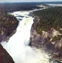
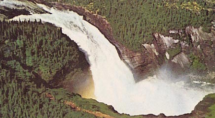
As we got closer to the Mingan archipelago, the distance between villages became greater. The landscape changed -  untouched by development. The number of English speakers dropped to zero.

A lobster fisherman from New Brunswick came for a visit when he noticed our Ontario plates. Weathered and darkly tanned, he was a born storyteller.  He regaled us with tales of local traditions and about the woman he had fallen in love with and followed to the Mingan area some twenty years previous. Prior to his arrival, he told us, there was no electricity in their small village. Local fisherman, who needed to store their catch in a cold place in the summer months, would navigate their fishing vessels to a nearby small island with hills that were snow covered year round, fill their boats with snow, haul it back to the mainland and shovel it into well insulated storage sheds - their version of a freezer.

The system worked well, he explained, until the year he showed up those many years ago. His first summer in rural Quebec was also the last summer that the snow remained year round. Now, when spring arrives, the snows melt as the birds return north for the summer.

Although there are now roads to this region of the country and electricity in every house along the St. Lawrence, I can't help but wonder about the great adjustment these small villages must have experienced as their way of life changed and how they coped in the years after the weather warmed and before the modern world intruded.

The St. Lawrence river widened as we continued along the north shore until we could no longer see land on the other side. The rise and fall of the tides became more evident. Incredible. In 1858, Charles Mackay, editor of the Illustrated London News wrote, "Familiarity with [the St. Lawrence river] breeds no contempt. On the contrary, the more it is known, the more it is admired. Without exaggeration, it may be called the chief and prince of all the rivers in the world."

Eastern Canada road trip - Toronto to Tadoussac

The morning of our departure on our great Canadian adventure dawned sunny and warm.  After a devastating hurricane had delayed the trip several times, we were so excited to finally pack up the car and head out. Three girls on an adventure. Destination unknown. Our only plan - drive around the east coast of Canada. We had no deadline, no reason to rush anywhere.

Our first stop was Canadian Tire - we still needed a few last minute items. Then, 400 south to the 401 - the highway of heros - and east. At some point we pulled off the highway and headed north through Ontario farm country, crossing into Quebec in Hawksebury/Grenville.

The bridge between Ontario and Quebec in Hawkesbury/Grenville (photo credit: Brianna)

Carillon Canal Locks National Historic Site

After crossing into Quebec we drove along the north shore of the Ottawa river, where there are some spectacular old French homes. We stopped for a break at the Carillon Canal Locks National Historic Site, which encompasses the canal locks, a hydroelectric dam and a museum in former barracks. Our newly purchased camera chose this location to break down - on our first day!

Oka National Park

Our first night was spent at Oka National Park, the site of the well-known conflict in 1990 between the Mohawk, who wanted to reclaim local burial grounds and a pine grove that was sacred to their people, and the town of Oka, which wanted to build a golf course and condos on the same land. The Oka crisis brought national attention to native issues and aided in the development of Canada's First Nations Policing Policy.

We had a great site near the beach, where we were lucky enough to be visited by foxes, raccoons and skunks.

Pointe-du-Moulin Historic Park

While our camera was in for repairs at a shop in Montreal, we spent the day at Pointe-du-Moulin Historic Park in Notre-Dame-de-l'Île-Perrot, an island on the outskirts of the city.

After picking up the camera, we continued our trip along the north shore of the St. Lawrence River past Quebec City and through the rolling hills along the Route des Baleines (Whale Route) towards Camping Falaise-sur-Mer, our home for the next night.

Our campsite was high above the river. The bugs were ferocious but the views were incredible. The shadows lengthened and the sky turned cotton candy pink and purple. Our dreams were accompanied by the sound of whales talking to one another.

A pretty swell campsite

Baie-Sainte-Catherine and Tadoussac

The Saguenay river, which flows between Baie-Sainte-Catherine and Tadoussac, can only be crossed by ferry.  In 1850, the New York Tribune wrote about the Saguenay river, saying it is "the most astonishing river on the globe - stealing along the eternal solitude of its fathomless gulf, between banks that tower far above the clouds."

The crossing is short but memorable. The river flows over a fjord that was formed during the last Ice Age when a crack was carved out by a receding glacier. Steep tree-covered cliffs hug the river and the water sparkles. The nutrient rich waters attracts whales and whale watchers alike.

On the other side of the river lies Tadoussac, Canada's first fur-trading post dating back to 1600.